
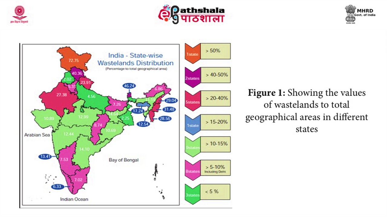
M-37. Applications of Remote Sensing and GIS in Wasteland mapping
M-37. Applications of Remote Sensing and GIS in Wasteland mapping – Detailed content covering key concepts and explanations
M-37. Applications of Remote Sensing and GIS in Wasteland mapping – Detailed content covering key concepts and explanations


Not Rated Yet